When The Earth MOVED
March 27 - April 2, 2023
By Jay Edwards
I was awakened by a crash like thunder ... the ground was shaking and a great wave came back north upstream and carried us for more than a mile with the water spreading out two or three miles inland. We saw many dead bodies floating down the river.”
That’s not a recent quote from Turkey or Syria, but rather one recorded over two centuries ago, in “The annals of St. Louis,” after earthquakes violently shook the ground in the area around New Madrid, Missouri, between St. Louis and Memphis.
On March 16, in Portageville, Missouri, the 5th Annual Earthquake Summit took place, to discuss, among other things, the likelihood of other devastating events like those in the area in 1811 and 1812. Once again, the experts at the Summit meeting discussed how to get people to become less complacent about an event that for many isn’t a question of if it will happen, but when.
While the public has, for the most part, been given accurate information on the areas of the planet that are at the highest risk of experiencing earthquakes, what they don’t have are adequate early warning signs, that come early enough in order that they can take safety precautions, whatever those may be. For the most part, scientists agree that predicting the exact moment an earthquake will happen is not possible. But they also agree that better precautions can be put into effect that can preserve structures people live and work in, and travel over, which will ultimately save more lives.
No country on earth has done a better job protecting its citizens from earthquakes than Japan, which sits on the Ring of Fire, also referred to as the Circum-Pacific Belt, a path along the Pacific Ocean known for active volcanoes, and whose region ranks first in the world for recorded earthquakes, where around twenty percent of all large earthquakes (a magnitude of six or greater) have been recorded.
The willingness of the country to spend billions on safer infrastructure didn’t come overnight. On September 1, 1923, the Great Kanto earthquake struck Tokyo-Yokohama, killing an estimated 140,000. More than half of the brick buildings in the cities were destroyed, along with hundreds of thousands of homes. But it wasn’t until the early 80’s, when Japan began changing its infrastructure codes by focusing on earthquakes, that improvements began. Then, in 1995, the 6.9 Kobe earthquake, which claimed nearly 7,000 lives, spurred even more efforts to protect people through safety and disaster management.
Today Tokyo skyscrapers can withstand a great deal of seismic energy, through technologies like bearings, hydraulics and even rubber squares, which act as shock absorbers.
While accurate predictions of earthquakes aren’t possible, scientists are able to forecast how frequently they will occur over a specified time. An example is the 370-mile section of the boundary of the Pacific and Australian plates in Aotearoa, New Zealand. Analysis of rocks along the fault has provided strong evidence that, over the past 8,000 years or so, one ground-rupturing earthquake of around magnitude 8.0 has occurred roughly every 300 years.
The most recent major rupture on the Alpine Fault was in 1717, more than 300 years ago. Using this data, earthquake scientists have estimated that there is a high probability – a 75% chance – of rupture on this fault in the next 50 years. There is an approximately 80% chance that the earthquake will be a magnitude 8.0 or above.
Those recent discussions in Portageville focused on those major fault lines much closer to home, in an area less than 200 miles east of Little Rock, whose fractures make up the New Madrid seismic zone, those weak spots in the earth’s crust also known as the Reelfoot Rift. They extend from Marked Tree in Poinsett County, in a northeasterly direction, crossing several states for about 150 miles, in what used to be the Louisiana Territory but is now the Missouri Bootheel. That was where, on Monday, December 16, 1811, at a little past 2:00 in the morning, many of the 400 residents of New Madrid, Missouri were jolted from their sleep to find themselves lying on the floor. Frightened people ran from their homes, and huddled together while animals ran by in different directions. Trees came down and houses were leveled. The earth swayed, shook, and gaped open in giant fissures that swallowed everything in their path. Then, around 7:15 a.m., just after first light, an even stronger earthquake hit the town.
There are reports of more than 2,000 tremors and aftershocks that took place throughout the winter months of 1812, into April. Accurate mortality counts are unavailable due to reporting agency damages and the remoteness of the area. One resident of New Madrid, Eliza Bryan, wrote the following eyewitness account in March of 1812: “On the 16th of December,1811, about two o’clock, a.m., we were visited by a violent shock of an earthquake, accompanied by a very awful noise resembling loud but distant thunder, but more hoarse and vibrating, which was followed in a few minutes by the complete saturation of the atmosphere, with sulphurious vapor, causing total darkness. The screams of the affrighted inhabitants running to and fro, not knowing where to go, or what to do—the cries of the fowls and beasts of every species—the cracking of trees falling, and the roaring of the Mississippi— the current of which was retrograde for a few minutes, owing as is supposed, to an irruption in its bed— formed a scene truly horrible.”
Today, the New Madrid Fault area is much more populated than it was 211 years ago, with the 29th largest U.S. city lying just inside its southern border.
On November 18, 2021, the day after a 3.7 earthquake in southern Missouri was felt in Memphis, memphismagazize.com reran a 2019 article by Jesse Davis, titled, “Is Memphis About to Shake, Rattle and Roll?”
For his research Davis interviewed the New Madrid Historical Museum administrator, Jeff Grunwald, and Dr. Kent Moran, a research associate at the University of Memphis’ Center for Earthquake Research and Information (CERI) for the last 20 years.
“Shockwaves from quakes in this part of the country travel up to 20 times as far as shocks from earthquakes on the West Coast. The reason for that is the bedrock in this part of the continent is much more dense. There’s less fracturing, so waves move through it much more easily and they go a lot further,” Grunwald explains. “I’ve run into people who say it wasn’t a bad earthquake because nothing was damaged,” Moran says. “I say nothing was here to be damaged. Now we’ve got stuff parked on the area. If you had the same type of earthquake, stuff would be hurt.”
Davis writes that as far as predicting the next “Big One,” Moran and Grunwald can offer little in the way of firm forecasts. “It’s a 5 to 10 percent likelihood in any 50-year window of a 7-magnitude event,” Grunwald says. “And a 6 magnitude, which is still a powerful quake and could do a lot of damage, that’s actually a 25 to 40 percent likelihood. There has not been a 6-magnitude quake since 1895 in this part of the country.”
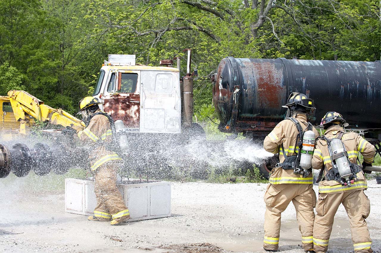
Photo Caption:
2. Firemen from Indiana Department of Homeland Security, keep water on a fireman as he closes a valve on an open gas line at the mock oil refinery during National Level Exercise in 2011, a full-scale exercise meant to represent the destruction following a 7.7 magnitude earthquake along the New Madrid fault line. (Wikimedia Commons)